Share This Article
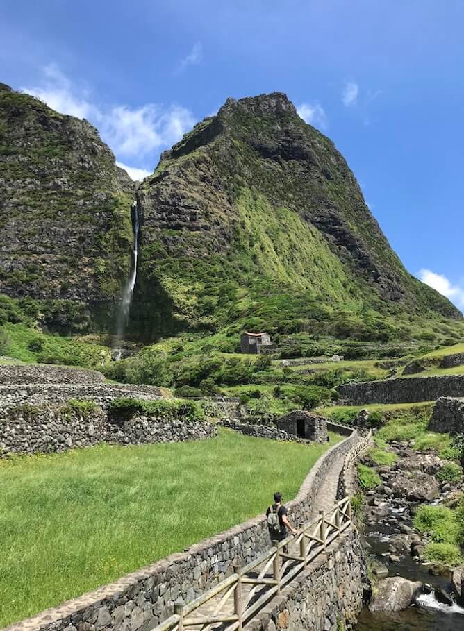
If there is one thing that gives Flores Island its name and visibility, it is its hikes and trails. In fact, Flores Island is quite small and it only has 5 trails available, but they are all very beautiful. Therefore, I recommend you to read my Complete Guide to Hiking in the Azores: all you need to know as it will prove very useful to you.
I would also recommend Booking a small group tour of Flores island with Experience OC. I have toured with them and I was impressed not only by how much I covered on a single day in Flores, but also by how professional and kind the guide was. From the best viewpoints to the most beautiful waterfalls, they really do cover it all on this day trip on Flores island.
Hikes and trails in Flores: which ones are available at the moment?
In this article about the best hikes and trails in Flores I will talk about most of them – not all of them, because there are currently two hiking trails that are not available due to their poor condition and soil instability.
The trails that are NOT available at the moment (2025) are:
- Stage 2 of the Great Route Flores, which connects Ponta Delgada (in the north of the island) to Lajedo (in the south). However, you can still do Stage 1 of the Great Route, which connects Santa Cruz das Flores, to the east, to Ponta Delgada, for a total of 21 km.
- PR01 FLO, which connects Ponta Delgada to Fajã Grande, is also closed at the moment.
Therefore, at the moment there are only 3 hikes and trails in Flores island that are open to the public:
| Trail Name | Difficulty | Duration | Length | Type |
| PRC04 FLO – Fajã de Lopo Vaz | Medium | 2h | 3.4 km | Circular |
| PR02 FLO Lajedo – Fajã Grande | Medium | 3h30 | 13.1 km | Linear |
| PR03 FLO Miradouro das Lagoas – Poço do Bacalhau | Hard | 3h | 7.3 km | Linear |
The best Hikes and trails in Flores
PRC04 FLO – Fajã de Lopo Vaz
Before I tell you about the first hikes and trails in Flores, let me explain what a “fajã” is.
Fajã is a “tongue” of flat land located by the sea, caused by either landslides of the nearby cliffs or by lava flows, from previous volcanic activity. There is a Canarian expression that describes fajãs as islas bajas, meaning “low islands”, and once you see one, you’ll understand the term: it is as if the island ended by the cliffs and yet some forgotten flat lands survived by the ocean. It is very poetic :)
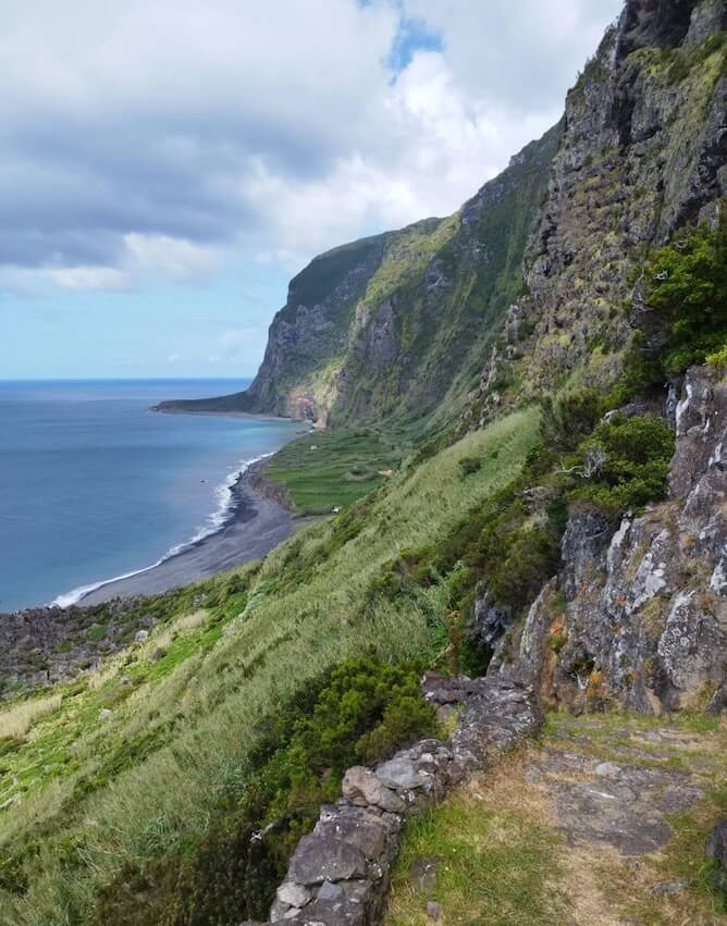
The Fajã de Lopo Vaz, where this hiking trail takes place, is a low platform, bordered by black sand and basaltic pebbles typical of the Azores islands, and formed by lava flows and the subsidence of the cliffs that overlook it. Today uninhabited, this fajã is a privileged place for bird conservation.
Moreover, the Fajã de Lopo Vaz, facing south and with a lot of sunlight at a low altitude, has a tropical microclimate, which is ideal for growing figs, araças, gooseberries and even bananas.

About the trail itself
The trail begins at the viewpoint of Fajã de Lopo Vaz, which is hidden by the cliff. From here you can see another fajã, further away, created by a ravine that occurred in 1980.
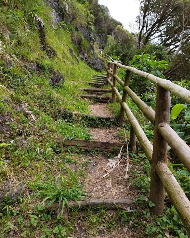
The trail alternates between dirt roads with wooden trunk protections, paved sections and, at times, stone steps to help you overcome the slopes. A few minutes after starting the descent, you will turn into a rocky path: you will reach a staircase that is said to have been built by Lopo Vaz himself in the first decade of the 1500s, and is perhaps the oldest visible human construction on the island, which descends in steep curves.
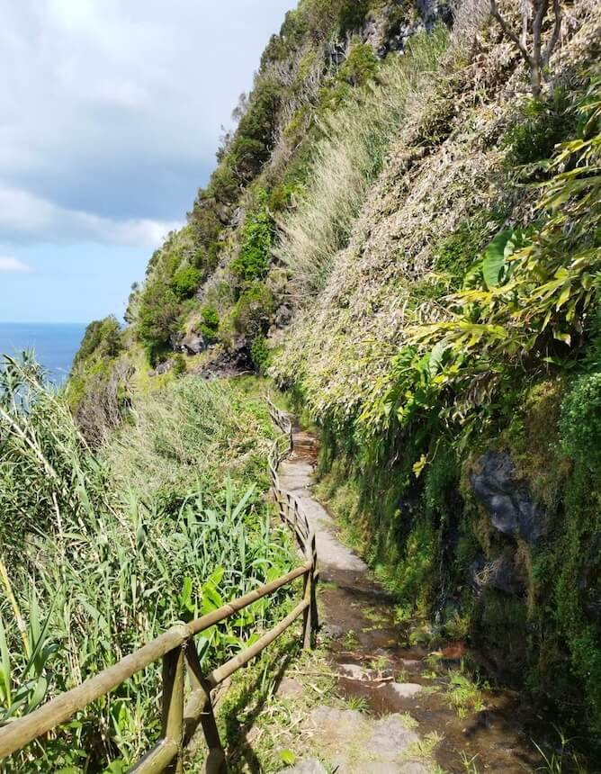
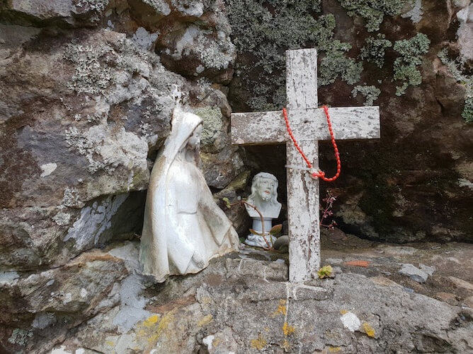
Right on the way down, you will find a niche with a small statue of the Virgin Mary and a cross. Along the way, you will find other religious images, perhaps to protect the visitors.
The path passes through a waterlogged area: step on the strategically placed stones to continue, and be careful not to slip. The water comes from the fajã’s only source, a spring that exists next to the cliff, over 350m high.
Finally, after descending for about 45 to 60 minutes, you will arrive at Fajã de Lopo Vaz.
There is a beach at Fajã de Lopo Vaz, but BE CAREFUL! I do NOT recommend swimming here, not only because the sea is rough but also because the waters are usually full of jellyfish.
There is no exit from the fajã, so you will have to return the same way.
The walk back up will be a lot more strenuous. Make sure not to come back during the hottest part of the day: the foliage traps the humidity and there won’t be a lot of breezes, and THAT can feel exhausting.
Practical information about this trail
- Distance to cover: 3,4 km (to go and come back!).
- Average duration: 2h.
- Type of trail: circular.
- Difficulty: Medium.
- Trailhead: Miradouro da Fajã de Lopo Vaz (it’s a viewpoint).
- Car park: yes.
PR02 FLO Lajedo – Fajã Grande
The beginning of this hike and trail in Flores is in Lajedo, next to the church. You should visit it, it is beautiful :)
Climb up next to the Casa do Espírito Santo and walk a few metres until you leave the last houses behind and find a viewpoint, where the information panel is located and where the walking trail actually begins. Here, you can view Portinho do Lajedo, where the Slavonia steamship, sailing from the USA to Italy, ran aground in 1909. Having stopped just 25 metres from the coast, it was possible to evacuate all 597 people on board and remove most of their belongings.
It is now be 3 km long and 3 valleys until you reach the village of Mosteiros. Continue down the dirt track and at the first fork, go left, down a cobbled path.
In front of you is a small river which you will have to cross. After going around this peak, you will reach the Ribeira da Lapa valley and, soon, a stone bridge. Then enter the third valley, Ribeira do Fundão.
You are now inside a protected area.
There is a steep climb of around 130 m (of elevation gain, not extension!) to reach the village of Mosteiros. It only has 43 inhabitants, so don’t be surprised if you don’t see anyone to greet you or ask for directions.
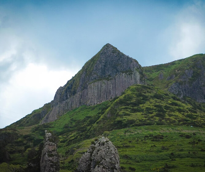
Here you will be able to see the imposing Rocha dos Bordões, which I already mentioned in my article on the best things to do in Flores.
Go down, passing a church, with a fountain in front where you can cool off. Continue down Rua do Cabo de Baixo das Casas, until it turns right. Leave the asphalt there and go down on a concrete road, passing next to a well-preserved house with some Azorina vidalli, one of the most beautiful plants of the Azores.
After crossing a bridge, you will find some haystacks that are well-framed with the landscape, which will allow you to take some beautiful photos of this rural landscape.
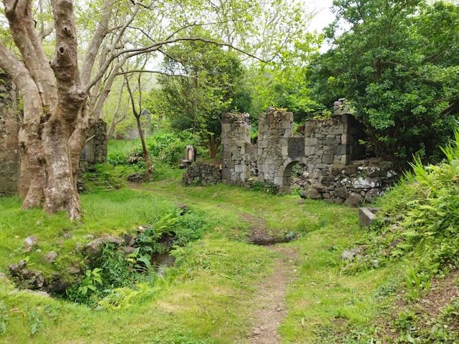
Go up to the road and walk for about 800 m. Leave the asphalt road and turn onto an old path on your left, passing by the ruins of houses swallowed up by vegetation. This is the famous abandoned village of Caldeira do Mosteiro, that I already told you about on this blog.
After leaving the road, go on for about 200 m and take the path on your left, next to a water reservoir that runs along a hill on the seaside: Cruzeiro da Fajazinha, a privileged viewpoints.
This shortcut takes you to Ladeira do Portal: the old descent down the escarpment that for centuries was the only road for vehicles that connected Fajãzinha to the rest of the island. It is often more than 2 m wide and it partly maintains the original pavement.
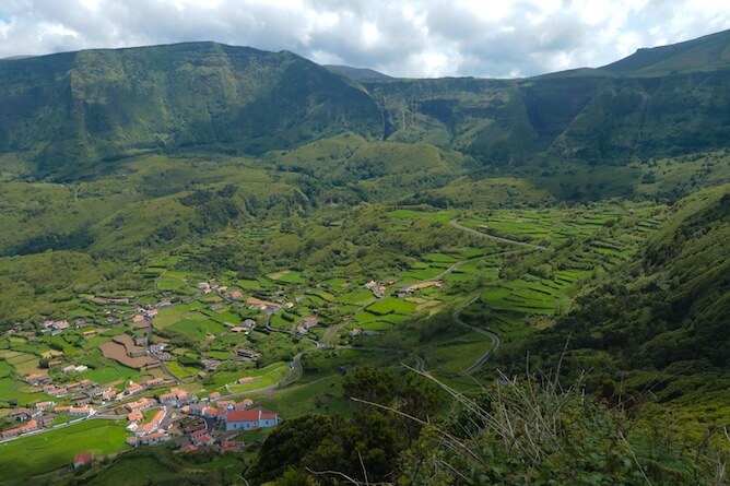
The first glimpses of the Fajãzinha valley appear, in an amazing landscape, where the recessed cliffs and several waterfalls capture our attention.
The entrance to Fajãzinha is near its church. Take a tour and admire the paintings on the ceilings and altars, the pulpit in brownish wood with fine gilding, the columns painted in imitation marble and other details.
Go around the café on the right, turning left behind it, and you will arrive at Largo do Outeiro, next to a small chapel. Go down to the right, next to the drinking fountain, and follow Rua do Engenho. You will come to a path that goes down to the “Traditional Cheese Factory”, but you should go up it by turning onto Rua do Espinhaço. Further on, continue up the path, to your right.
When you come out onto the road, you will come across a water mill. Although it is privately owned, it is operated by the Lajes Town Council, which hired Mrs. Maria de Fátima to show visitors how a mill works. It is well worth a visit!

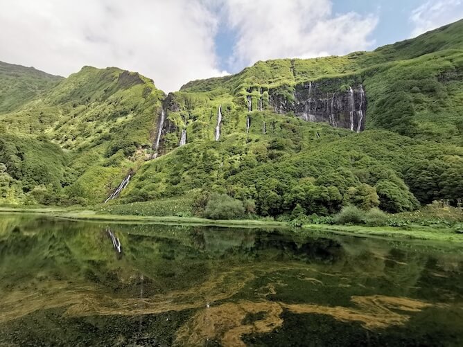
Follow the path towards Fajã Grande, passing over the Ribeira Grande bridge. A sign indicates: Poço da Alagoinha. Take this 800-metre detour to enjoy the most amazing landscape on the island of Flores, the famous Poço da Ribeira do Ferreiro.
It is an enchanting landscape, where more than a dozen waterfalls continually release their waters from the top of an imposing and verdant rock into a calm lagoon.
NOTE: if you wish, at this point you can take a small detour on the route to visit the famous Aldeia da Cuada.
After passing through Cuada, follow a cobbled path that leads to a chapel. From here to Fajã Grande, we follow the paved road again, until we find the Main Street of the village: Rua Senador André de Freitas.
Next to the church, you will find a convenience store (minimarket and bar), a must-stop for a refreshing drink or to try the owner’s “mistura”, a sweet alcoholic drink .
The path takes us to the port, perhaps the only one on the west coast of the island, now used mainly by pleasure boats.
This pedestrian route ends a few meters from this junction, heading right along the path that leads to Ponta da Fajã. However, continue straight ahead, passing a barbecue and picnic area until you reach the bathing area, where you can cool off.
Practical information about this trail
- Distance to cover: 13,1 km (to go and come back!).
- Average duration: 3h30.
- Type of trail: linear.
- Difficulty: Medium.
- Trailhead: Hike Lajedo-Fajã Grande, near the church of the town of Lajedo.
- Car park: no, but it’s not too difficult to park in Lajedo.
PR03 FLO Miradouro das Lagoas – Poço do Bacalhau
In my opinion this is one of the most beautiful hikes and trails in Flores, if not THE most beautiful one.
The trail starts at one of the most beautiful viewpoints on the island, the Miradouro das Lagoas Negra e Comprida.
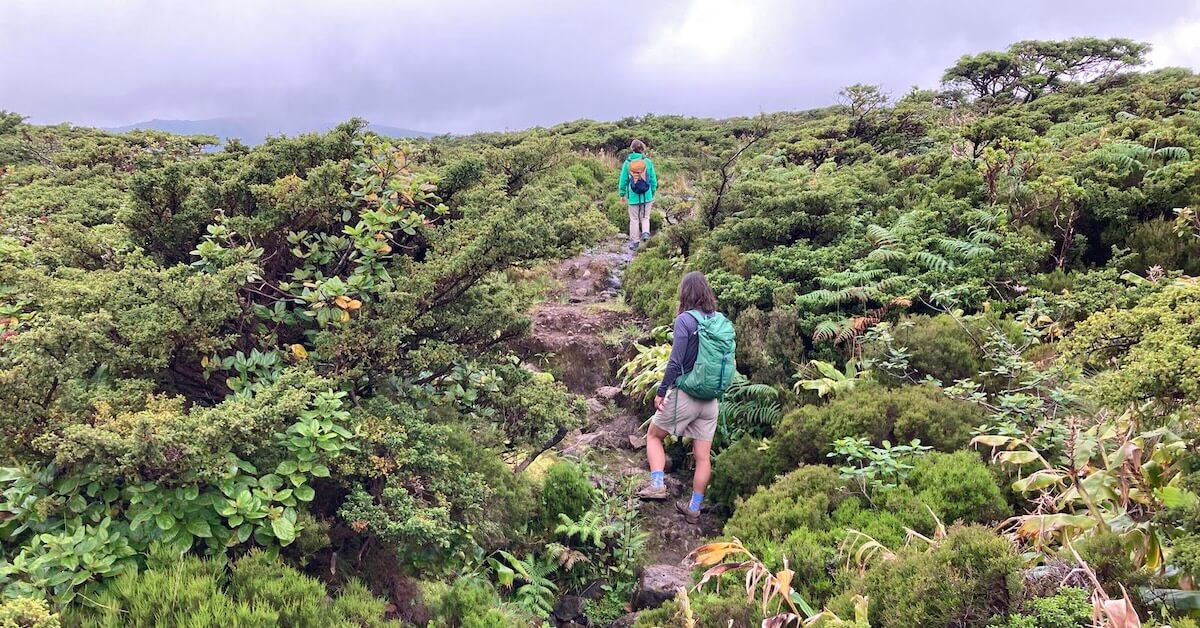
First, explore the area around the four crater lakes on the Flores plateau, before descending towards Fajã Grande, where you will visit the Poço do Bacalhau waterfall. Going around Lagoa Comprida on your right, you will have a beautiful view of Caldeira Comprida, with its yellow tones. Pass Lagoa Seca and the huge and fantastic Caldeira Branca. Pico do Morro Alto, the highest peak on Flores Island (914 metres), is just behind – hidden in the fog on the day of this hike.
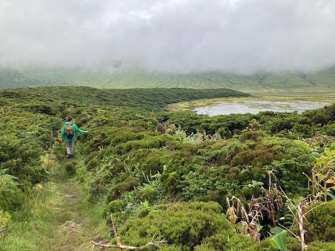
This first part, which takes place at an altitude of around 600 metres, is around 5 km long. Do it in good weather (i.e. with good visibility), otherwise you will miss the best parts of this hike.
The ground at the top is usually quite flooded, so it is almost impossible not to “put your foot in the puddle”.
From there comes the difficult part of the trail. The biggest challenge is the zigzag descent towards Fajã Grande, which is steep (a drop of 600 m in altitude over 2.5 to 3 km, which is quite significant).
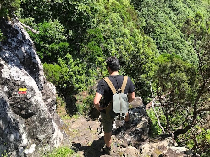
In bad weather conditions (fog, slippery after rain) or for anyone with vertigo, this trail can cause some problems, both due to its enormous drop in height and the very slippery rocks and mud, which requires great care.
At the end of the trail you will be rewarded with the fantastic Poço do Bacalhau waterfall, which is the ONLY place on the island where you can take a freshwater bath :)
During the months of July and August, you can use the bus connection between Santa Cruz das Flores and Fajã Grande. In the morning, the bus leaves Fajã Grande at 8:00 am and then returns from Santa Cruz at 8:35 am, in both cases taking you to the start of the walk. You need to tell the driver that you want to get off at “4 Lagoas”. In the evening, the bus returns from Fajã Grande to Santa Cruz at 5:15 pm, passing by the starting point of the walk (if you left your rental car there).
During the remaining months of the year, you will have to call a taxi to take you to where you left your car. At the tourist office at Flores airport, you will find a list of the telephone numbers of taxi drivers on the island (there are only 6 or 7 at most). Otherwise, I also have that information on my article about How to get around in Flores Island.
You will have to pay between €20 and €25 for this trip.
Practical information about this trail
- Distance to cover: 7,3 km (one way).
- Average duration: 3h.
- Type of trail: linear.
- Difficulty: Hard.
- Trailhead: Miradouro das Lagoas Negra e Comprida (it’s a viewpoint).
- Car park: yes, but it’s quite small and it gets packed easily. Go early!
FAQs about the best hikes and trails in Flores
What is the best time of year to hike?
The weather in the Azores, but especially on Flores island, is very tricky. If you want to explore hikes and trails in Flores, the best time of year is undoubtedly summer, from June to the end of August. Even September is a risky time – I already caught A LOT of rain in September in Flores.
Can I do the hikes and trails in Flores on foggy days?
There is one trail in particular that I really recommend NOT doing on foggy days because you won’t see anything, which is trail PR03 FLO Miradouro das Lagoas – Poço do Bacalhau.
Now, if the starting point is in the center of the island, how can you know if there is fog up there or not that day?
It’s simple: go to the Spot Azores website and check the webcam installed on the island of Corvo, which is located opposite the island of Flores. If the island of Flores is covered in clouds in the image, then it’s not worth trying to go to the lake craters because you won’t see anything.
As for the other two trails (PRC04 FLO – Fajã de Lopo Vaz and PR02 FLO Lajedo – Fajã Grande), as both trails run along the seafront and are therefore at low altitude, you can, in principle, do them on foggy days.
What if it is raining?
I usually don’t mind hiking in the rain, but the hikes and trails in Flores are quite technical, so I don’t recommend you to do them on rainy days because you’ll probably get hurt and then you’ll be totally screwed. Don’t forget that there are no hospitals on the island, as I already told you in this article about the BAD things about Flores Island.
Instead, follow my suggestions of what to do on a rainy day in Flores island.

